Director of Civil Engineering and Development views landslip prevention and mitigation works (with photos)
******************************************************************************************
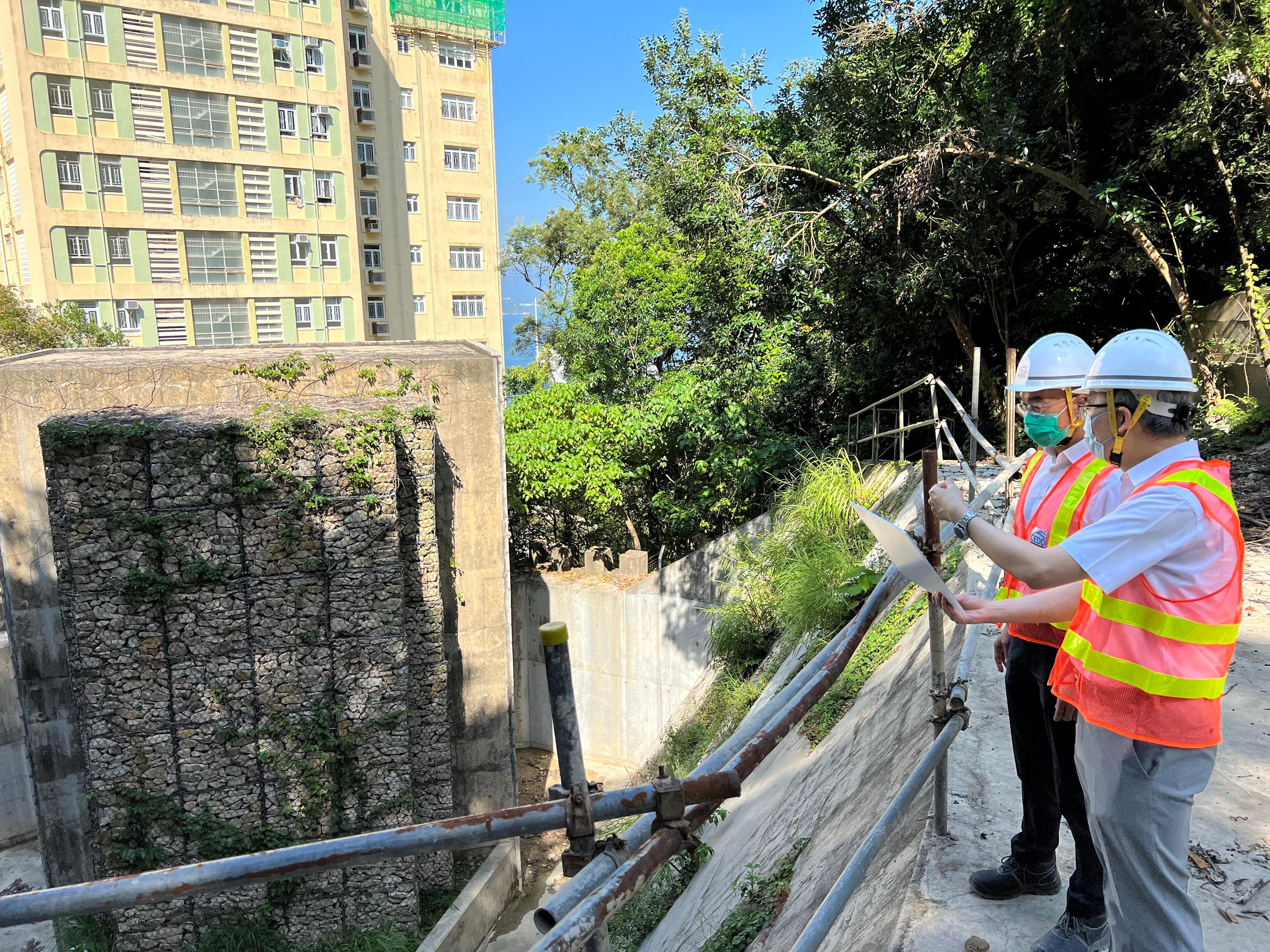
Accompanied by the Head of the Geotechnical Engineering Office (GEO), Dr Raymond Cheung, Mr Fong viewed a rigid debris-resisting barrier located behind Block 3 of Middleton Towers. Constructed in 2013, the barrier successfully contained the debris flow on a natural hillside, with a failure volume of approximately 110 cubic metres, on August 3 last year, thus protecting the facilities of Middleton Towers.
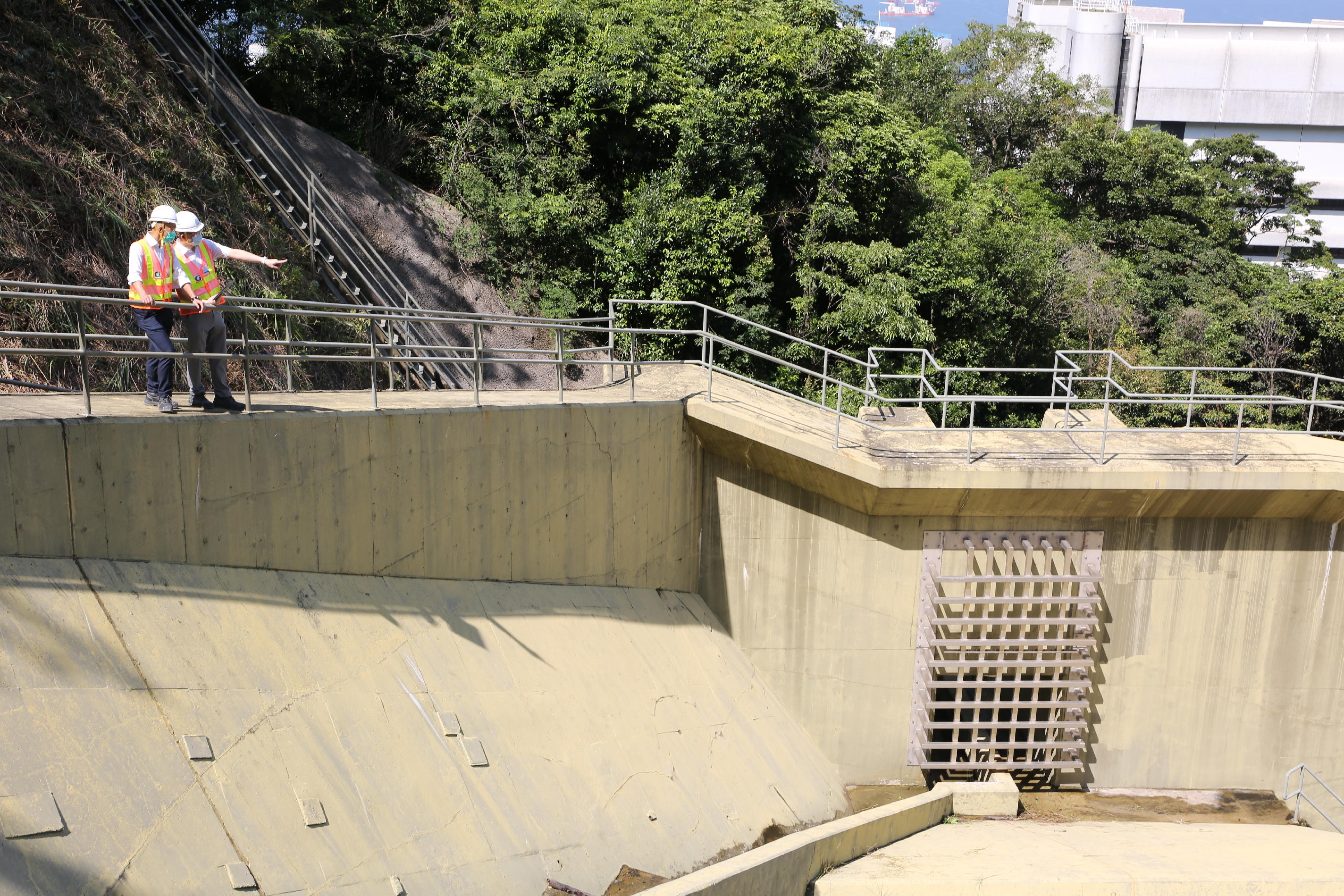
Mr Fong then viewed a rigid debris-resisting barrier equipped with the Smart Barrier System behind Queen Mary Hospital. The barrier was constructed in 2016 and installation of Internet-of-things devices of the Smart Barrier System, which were developed by the GEO, was carried out in 2019. In the event of debris flow, when landslide debris hits the impact switches, the system will immediately send impact alert signals and data, including details of debris thickness and images of the scene, to the monitoring officers, enabling timely arrangement of engineer inspections and follow-up action to enhance public safety.
Mr Fong also visited the GEO's Emergency Control Centre earlier. When the Landslip Warning and/or Tropical Cyclone Warning Signal No. 8 or above is in force, the GEO will activate its Emergency Control Centre, which is manned by 13 emergency teams on a rotational basis. When the Emergency Control Centre receives landslide reports, geotechnical engineers will be deployed promptly to the landslide sites to provide necessary advice to other government departments.
In addition, the GEO manages the Common Operational Picture, which is a common Geographic Information System platform for real-time sharing of natural disaster-related emergency information, including details of landslides, flooding, building damage and major road incidents, among government departments to enhance the co-ordination of the departments' emergency responses.
Mr Fong reminded members of the public that when the Landslip Warning is in force or under prolonged heavy rain, motorists should avoid driving in hilly areas or parking vehicles in front of slopes. Pedestrians should avoid walking or standing close to steep slopes, and avoid standing between slopes and structures. When a notification to evacuate is received, people should follow rescuers' instructions and move immediately to safe shelter. If members of the public witness a landslide, they should leave immediately and call the Police if conditions permit.
Ends/Tuesday, August 23, 2022
Issued at HKT 20:20
Issued at HKT 20:20
NNNN
Photo